Since the Civic Amenities Act 1967, local planning authorities have been required to decide which parts of their area “are of special architectural or historic interest, the character or appearance of which it is desirable to preserve or enhance” and to designate them as conservation areas.

The designation of a conservation area has a number of direct legal consequences, including specific procedures for planning applications, the control of demolition of buildings, redevelopment, what is changed or rebuilt, and works to trees – this covers all trees on the property (such as in a forecourt or garden) which are over a certain size, and not just those with a tree preservation order (TPO).
Terms such as ‘permitted development’ have a different meaning for a property in a conservation area, the most common one being the size of an extension that can be built without needing planning permission. Also, within a Conservation Area, some buildings can be identified for additional attention/protection.
All this is in addition to guidance to be followed if the property is listed. This is a list maintained by Historic England. The older a building is, and the fewer the surviving examples of its kind, the more likely it is to be listed. Buildings that are less than 30 years old are not normally considered to be of special architectural or historic interest because they have yet to stand the test of time. Listing is not a preservation order, preventing change. It doesn’t freeze a building in time, it simply means that listed building consent must be applied for in order to make any changes to that building which might affect its special interest (which could be its exterior and/or interior fittings).
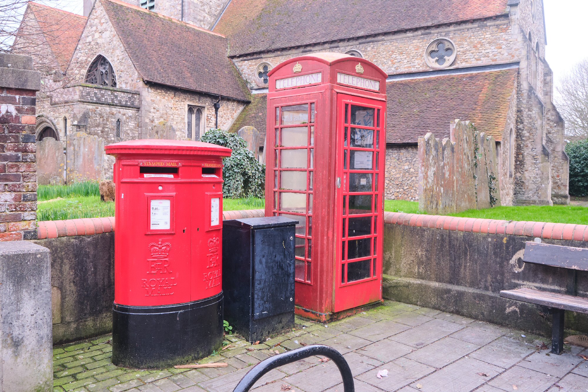
A listing category may also apply to street furniture, such as telephone boxes, lampposts and other artefacts. The telephone box beside St Faith’s church is grade II listed and a few years ago, I believe that the Havant Civic Society committee negotiated with the Post Office to have the broken door replaced. I think that the post box next to it is rather special too. Looking back at the black and white image here from the original 2007 Heritage Trail leaflet, it seems that at one point there were two separate pillar boxes, perhaps a ‘father and daughter’ pair following the death of King George VI and after the coronation of Queen Elizabeth II.
The first image in this set shows the double box we see today. The final image shows the rare King Edward VIII cypher above the main Post Office door in East Street, another restoration success for the Civic Society.


It is interesting that the designation of a Conservation Area was introduced in 1967, perhaps as a consequence of wartime destruction, and as a reaction to some of the rebuilding that had taken place since. Then again, restoration and reconstruction is usually far more expensive than a new build.
Havant Borough has 14 conservation areas 241 buildings of special architectural or historic interest (listed buildings) and some 83 buildings that have been identified as being of local interest. (These numbers were taken from the Council’s own data.) The newest listed building in Havant is Bosmere Junior School, this dates from the early 1980s.
There is much reference documentation about Conservation in Havant, most seems to be dated around 2007, and a great deal has happened since then! I’m not sure all the changes would have had the approval of a Conservation Officer or had the necessary paperwork to back it up!
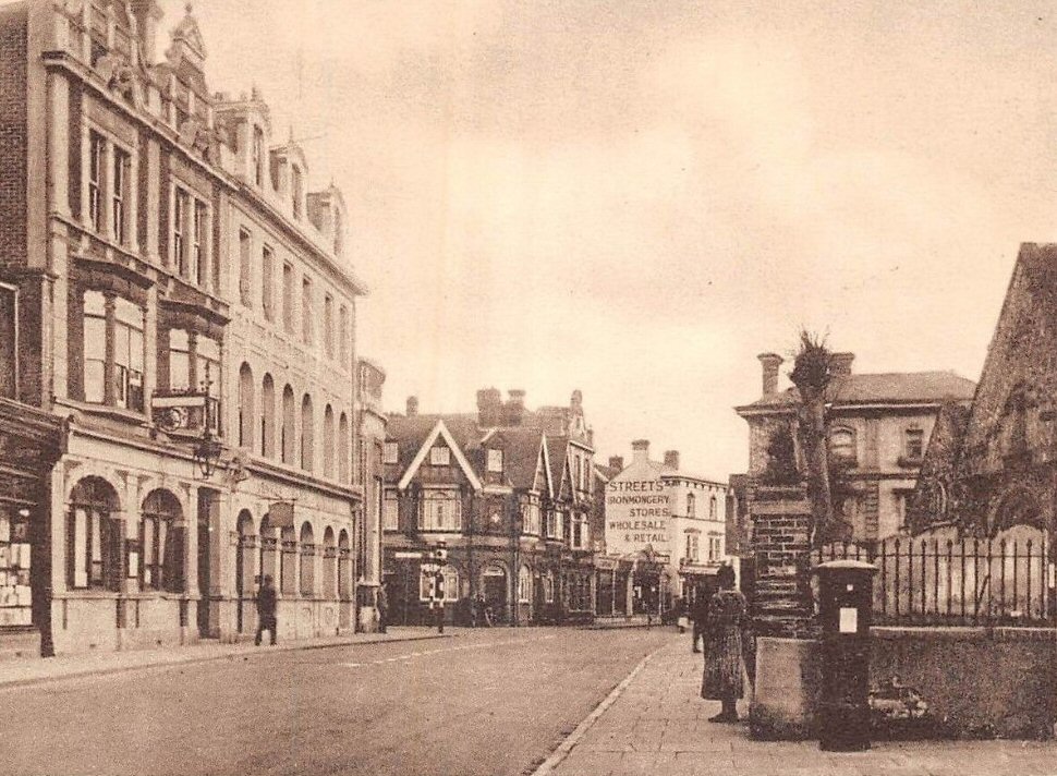
In 2007, the Streets building and neighbouring shops in East Street were still present and The White Hart was still a public house. Along North Street, The Star was still there and The Perseverance stood out as a gem – as it still does today as an Indian restaurant. All are noted in the documentation.
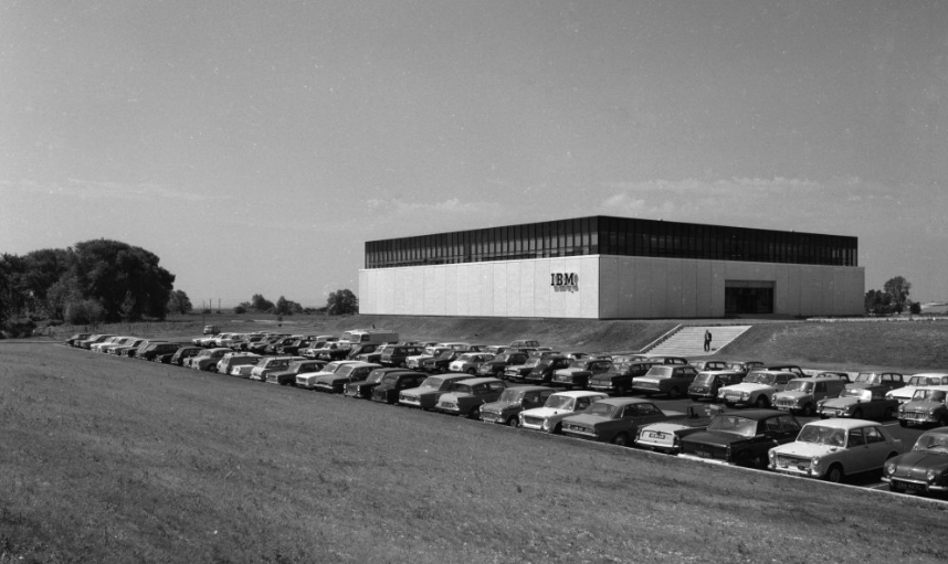
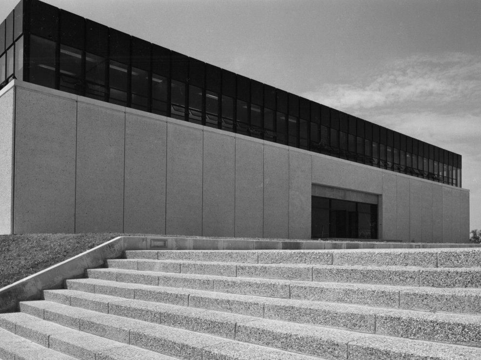
In the last few years, two significant industrial buildings have gone, both were candidates for listing. Interestingly they both opened in around 1968. The Colt building in New Lane, with all the exposed concrete perhaps a bit brutal for some, but very much of its time, is now gone and replaced by housing. The IBM building (in Langstone Technology Park) is also being redeveloped, as it doesn’t suit current business needs and has been written about here before


How many people visit Waitrose but don’t know the buildings behind; the dissenters’ chapel (grade II listed – now flats), the current building works alongside have exposed some old foundations, the two houses opposite the chapel are both grade II listed, as are the two houses by the tree. What is the story of the stone behind the gate of the Dissenters’ Chapel saying “T-N 1730” (see the heading image at the top of this article)? Has the stone always been there or was it moved from somewhere else? The chapel opened in 1718, so there could be a connection.
Then there is Manor Close – the site was the redevelopment of a grand house, but retains much of the house’s surrounding walls and gateposts (which may have been moved). Strangely, Fairfield Terrace, which is stunning and uses a variety of building materials and has a plaque celebrating 60 years of Queen Victoria’s reign isn’t listed.
The wall along the side of East Pallant shows where tanks readying for D-Day gouged the brickwork, and through the small carpark there is a Georgian gazebo.
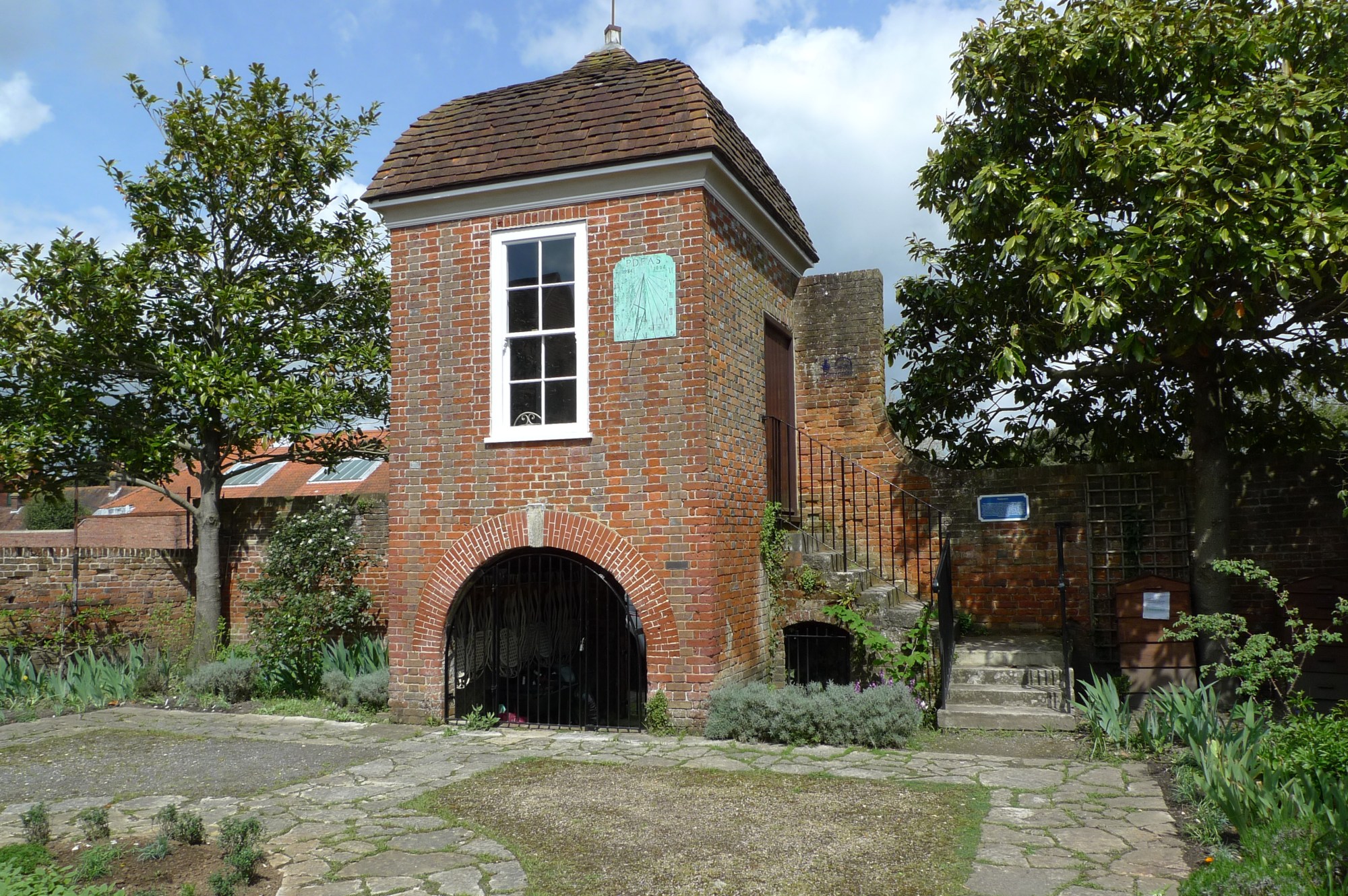
This garden once belonged to one of the big houses on East Street; a place where the owner could ‘gaze out’ over his garden. For more details see this earlier post. That’s quite a variety in such a small area.
You may notice blue plaques on some of the buildings around Havant, these form a Heritage Trail; a pleasant guided walk through the town. See link to the guides at the end of this post; it’s a little out of date, but provides a good overview.
The styling of Havant railway station, is rather special – the design is reminiscent of 1930s cinemas following branding used by British Rail/Southern Region. The signal box is grade II listed and there have been a couple of attempts to ‘do something’ with it, but as yet they’ve come to nothing and it looks very sad, although its currently neglected state provides an ideal nesting ground for local sparrows.


Then there are all the things which I think are of interest that don’t appear on any council list, a few examples being ‘The George Inn’ written in the pediment of what’s now a funeral director’s business near Waitrose and opposite, the lighthouse stained glass window above St Faith’s Charity Shop. And there’s the piece of old stone wall forming part of the boundary of Morris Crocker’s car park, visible from Waterloo Road near the railway station.

Many history booklets about the town are available to buy at The Spring, and quite a few are available online.
For further information see:
Havant Borough Council’s page on Conservation areas and listed buildings.
The Havant Heritage Trail, including the Heritage Plaques for places of interest, some of which are listed, is currently being refreshed. The earliest version of the guide can be downloaded here and it forms an interesting historical document in its own right, compiled by Havant Town Centre Management Ltd, sponsored by Havant Borough Council and George Gale & Co with the blue plaques sponsored by Havant Rotary.
Information about the United Reformed Church in Havant:
Local History Booklets from The Spring collection.
Historic England map search for details of Listed Buildings.
For those who can’t quite place the date stone illustrated at the top of this post, the picture below should give you a hint.

While we’re on the subject of history and heritage, you might like to check out our report on the Local History Summit recently held at The Spring. Click the image below for details.